I've been experimenting with the flat earth theory. This is something I'm doing as a hobby, and don't want anyone to think it's something I prescribe to, but even now, after writing this, I must admit that I am almost ready to accept it. Full heartedly. At the end you may see why. This has been an amazing journey. If I'm wrong I'd like someone to explain this to me, and I will gladly withdraw my position.
The above map is interesting. It's said to have been published by Buffalo Electrotype and Engraving Co, Buffalo N.Y, U.S.A. It depicts the world as being flat and encircled by a ring of ice. The ring of ice is common in the flat earth theory, but we'll get to that later. Lets explore the map a little more. The following is a Google search of the company.
https://www.google.ca/search?biw=1242&bih=566&q=Buffalo+Electrotype+Engraving+company%2C+N.Y%2C+U.S.A&oq=Buffalo+Electrotype+Engraving+company%2C+N.Y%2C+U.S.A&gs_l=serp.3...2964.10784.0.11303.14.12.2.0.0.0.725.2517.0j8j3j6-1.12.0....0...1c.1.64.serp..0.2.265.mbYgxSUAFgM
I'll be honest. There's not much to go on, but it's not a complete dead lead. Sadly, most of the links are referring to this map, such as this government link from Library of Congress, in the United States.
https://www.loc.gov/rr/scitech/SciRefGuides/flatearth.html
Quote
"Gleason, Alex. Is the Bible from heaven? Is the earth a globe? 2d ed., rev. and enl. Buffalo, N.Y., Buffalo Electrotype and Engraving Co. [1893] xix, 402 p. illus., map, col. plates, ports.
QB638.G56"
If fact that entire page is dedicated to flat earth. Too bad there isn't more information on the map. Not finding anything on the company means it either didn't exist, or it did not get very big. We won't let that discourage us. This is going to get plenty of interesting. Believe me.
You might find it interesting that the UN's own flag is also this flat earth model.
Why? An inside joke? Or do they have something to hide? Well, if you're interested in this already, you're going to learn a lot from the following montage. We'll cover the science first, and then we'll get into the theory. Some of you might be thinking, science, are you kidding!? There's still science for the flat earth? You might be surprised to learn that there has never NOT been science for the flat earth. Thousands of years ago most everyone believed the earth was flat, it was not until modern science, and pre-modern science (in a time period when it could not be proved) that the earth was turned into a globe. We'll cover it all over the next few minutes.
Fair warning: The videos are long, but most of the best info is in the first 40 minutes of each.
US Navy Missile Instructor Confirms Flat Earth
In the video above a US Navy Missile Instructor admits that he's been considering the flat earth theory. He also suggest that curvature, as per our current science, is proved false by a 2 inch beam reaching targets at 50 miles, and a 2 degree pencil beam at that. He also mentions seeing ships at 27 nautical miles while being told in training the horizon is at 15.
Career Commercial Land Surveyor: No Curvature Calculated
Very interesting video. Surveyors are taught to work from a flat plane. They never take into account the curvature according to this video. The surveyor said he never noticed it, but then he thought about large cities. Eventually these chessboards of flat planes bumping up against each other would have to take into account the curvature. Consider an entire city built by surveyors going on their lessons of working from a flat plane. Doesn't make sense in a curved world, right?
US Navy Chief: What Curvature?
The surface of the water, according to mainstream science, follows the curve of the globe. This Navy chief suggests curvature is not accounted for. He also suggests pilots flying large distances also do not adjust for the curvature.
Retired US Air Force Navigator
The above video contains an individual that is well decorated, including a masters in space. He makes the claim that the horizon must recede on a globe, but this has never been observed in his work.
Astrophysicist Shuns Flat Earth
The above video is hilarious. An astrophysicists shuns a flat earth query and gives perfect slope for explanation of curvature.
I'd like to say this is the tip of the ice berg (this will become a pun not too long from now.) There are many professionals out there that are now coming out about believing in a flat earth. We'll carry on though. Lets get into the interesting stuff. From here on out information will be part truth, and part theory. I have to give my usual warning. There is some religion involved with areas of the flat earth community. I do not subscribe, nor do I suggest anyone else subscribe, to anything outside Christianity. Please be careful in this sense.
Time Lapse Of World
The above video suggests that NASA has been faking time lapses of the world. Consider the second one shown where clouds do not even move.
Masonic Sun Worshippers
The above video covers masonic astronauts, and the masonic scientists involved in the globe system.
Manic Art Proves Flat Earth
The above video suggests the oldest, and farthest reaching fraternity, is well aware of the flat earth. At the highest levels of course. Remember these guys have a temple in every town and city from here to Jerusalem, where they have set up right beside temple mount.
What's the key to the edges? Antarctica. It's a ring of ice around the world! People like to point out that all Antarctica images from satellite are composites, and that there are no real space images of Antarctica. Some people consider the idea that they may be hiding Antarctica for other reasons.
The following image is a picture of Antarctica treaty meeting area. Some say the entire building is designed after the truth, and the blue surrounding the earth is a depiction of the ice walls. After finding truth about Antarctica the government formed NASA, and both Russia and America did high altitude nuclear bomb tests called "Operation Fish Bowl." Interesting naming convention.

Now we get into the idea of how they keep us from the truth of our earth, should of course this conspiracy be the truth. The obvious is indoctrination. They teach us as kids that the earth is round. They use fake NASA footage, and avoid areas such as Antarctica altogether, and well, they control the flow of traffic.

The image above shows shipping lanes. On a flat earth model one would say they are all intercontinental, and no one is going above, or below, a certain point.
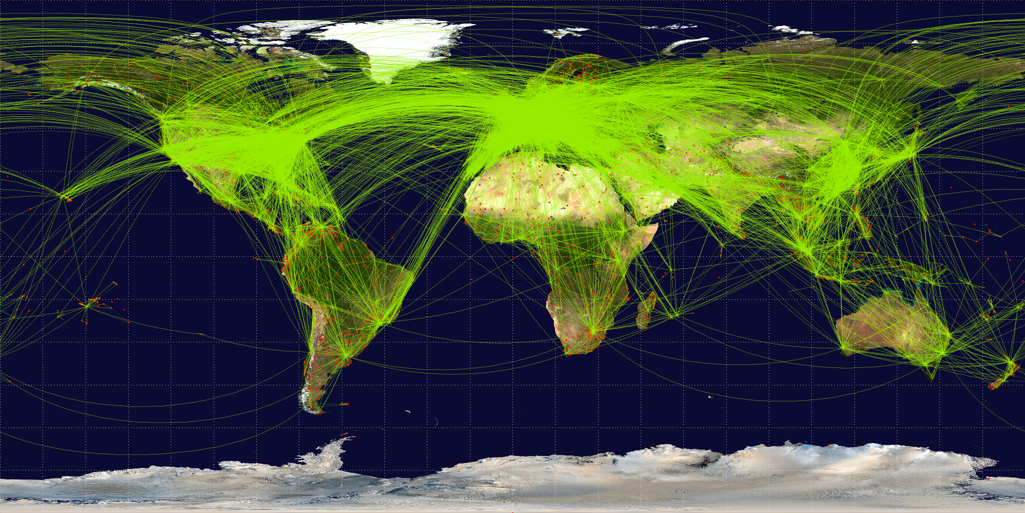
The image above is flight paths from satellite imaging. Notice the same thing. On a flat earth model the flights are all intercontinental. No one is flying above a certain point, and no one is flying below.
Now here is where I'm going to blow your mind with my own personal research, as if the other stuff I've showed you shouldn't have do so already.
Check these images out again.
The above image is on an article dated 2014.
The above image is dated 2009.
It's interesting that satellite images render ice, that is really no bigger than the width of America, as something that stretches the entire length of the world. Is it possible this is because it's on the bottom of a sphere? Or is it because that massive chunk of ice stretches as far as the eye can see?
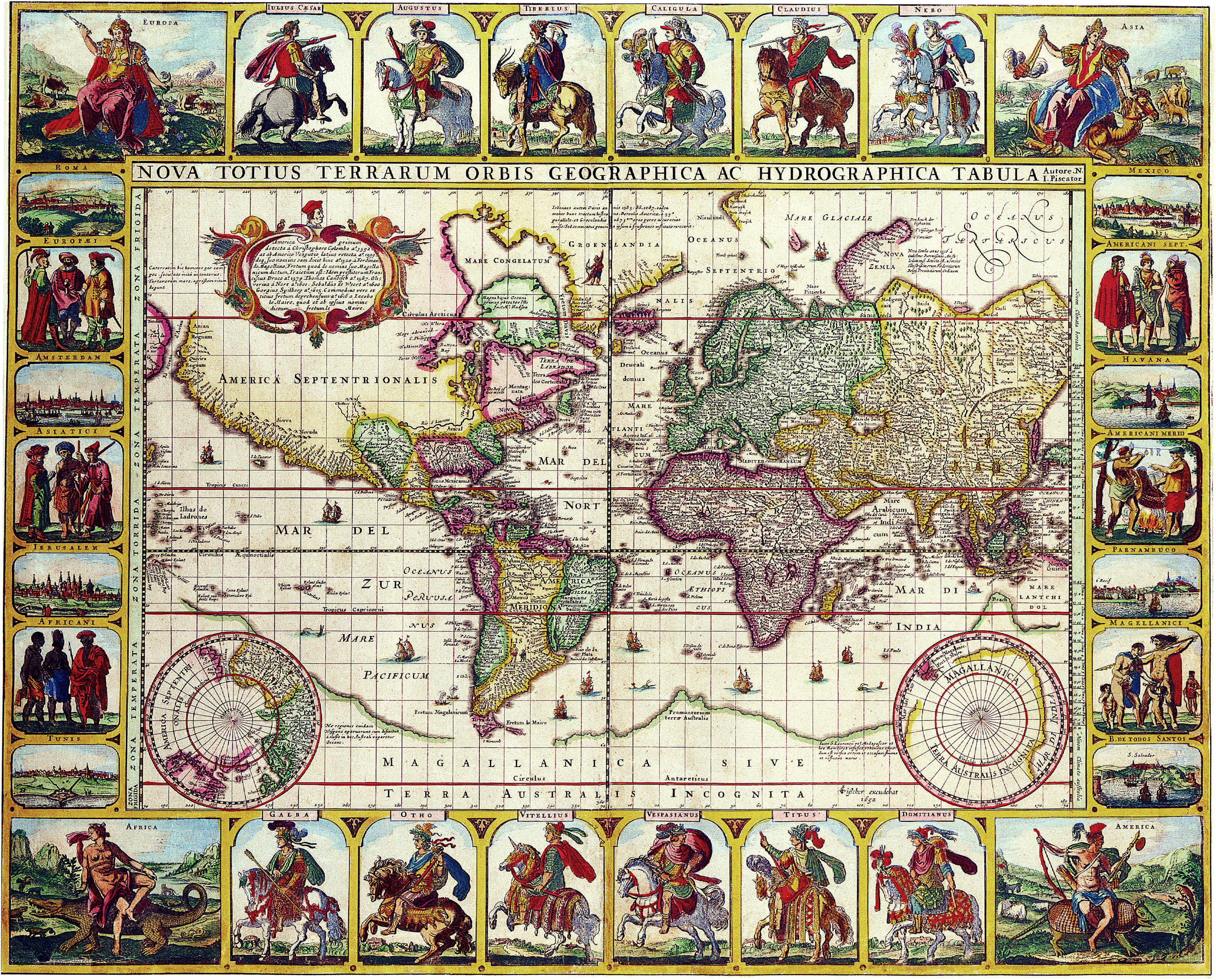
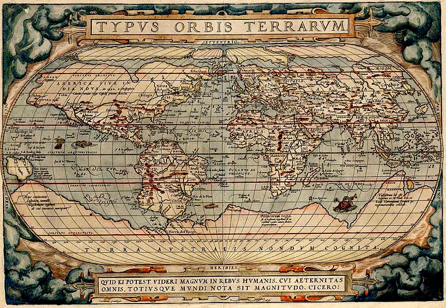
Here's another old map dated 1570. This on the other hand is a mere 27 years after Copernicus introduced the heliocentric model. Notice nothing changed about the massive lower land mass but the name. Back then they were contemplating Australis.
Now the mind blowing part of this entire thing. This is provided from NASA itself.
"Composite map of the world assembled from data acquired by the Suomi NPP satellite in April and October 2012. Credit: NASA Earth Observatory/NOAA NGDC"
Here's another.

Notice again this image shows the ice walls at both ends of the earth. See the globe in the bottom left? Now look at the top of the world. The north is already rounded, but the satellite is showing much more ice, in fact, another world wide stretch.Here's another.

And another.

The north is only small on Google earth.

How about flights at the bottom of the world?

None. Is it because it's too long of a haul? Maybe it's a safety issue, or all the major land masses are more accessible through northern routes or near the equator. If not, maybe it's because the bottom of the world really the edge of the world.

Above is an image from ISS (Internation Space Station) control. See how the screen calmly shows its workers the massive ice north and south?
Above is Russian control. It also shows the same ice.
If I'm not scientifically wrong about this ice wall, remember how they kept it a secret.
The flow of traffic, and some would say, and the end of a gun.


